 |
||
| Cricccieth Castle | ||
 |
||
| View from the top of the castle towards the West | ||
 |
||
| View from the top of the castle towards the East |
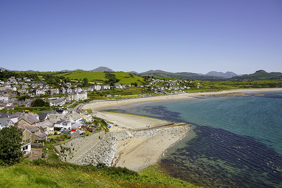
I made a flying visit to Criccieth in June 2019 but had time to look only at the top of the town and the castle. As my pictures show, there is much more to see on either side of the castle at sea level.
Criccieth lies on the Llyn peninsula in the Eifionydd area of Gwynedd in Wales. The town lies 5 miles west of Porthmadog, 9 miles east of Pwllheli and 17 miles south of Caernarfon. It had a population of 1,753 at the 2011 census. It is thought that the castle was built around 1230 by Llywelyn ab Iorwerth, who had controlled the area since 1202; the first record of the building was in 1239, when the administrative centre of Eifionydd was moved from Dolbenmaen. Llywelyn's son Dafydd ap Llywelyn died without heir in 1246 and his nephew Llywelyn ap Gruffudd succeeded. In 1272, Edward I became king of England and soon afterwards began the conquest of Wales. By 1277 he had progressed along the coast of North Wales as far as Anglesey. By the Treaty of Aberconwy, Llywelyn ap Gruffudd recognised Edward as his king. By 1282, Criccieth Castle was part of the ring of fortifications built by Edward on the coast of Wales. They were located there so that if necessary they could be reinforced by sea. The castle was extended and a township was built around it to support the garrison. A charter of 1284 promoted the settlement of English peopld to provide food for the soldiers. A market was established and the town had fairs on 25 April and 18 October the feasts of St. Mark and St. Luke.
Criccieth became a holiday resort in the 19th century and has a fine stretch of beach.
|
|
||
| Cricccieth Castle | ||
|
|
||
| View from the top of the castle towards the West | ||
|
|
||
| View from the top of the castle towards the East |
 |
 |
 |
| George IV Hotel | Auction House in High Street |